FireMapper
FireMapper is the purpose built mapping and situational awareness solution for emergency services agencies. Whether you're responding to wildfires, floods or a missing person, FireMapper has you covered.
-

All Hazard Symbology
Specialised emergency and hazard symbology covering wildfire, controlled burning, flooding, storm damage, search and rescue.
-

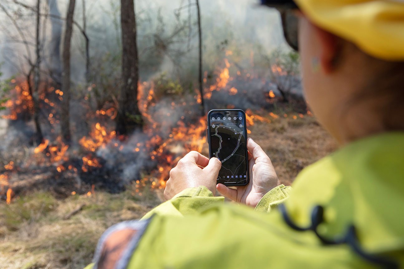
Real-Time Information, Available Offline
Collaborate and interact on shared maps, as well as real-time tracking of appliance and aircraft locations. Designed to be used in the field, FireMapper functions even in areas with limited or no Internet access.
-

Seamless integration
FireMapper effortlessly integrates with your agency's IT and GIS systems, including CAD and COP platforms. Say goodbye to information silos and hello to a more cohesive workflow.
-

Operational Focus, Better Decisions
Designed by a team of emergency service personnel to support operational processes, at incidents and in the air. Accurate information, easily shared, supporting better decisions.

Built to be used in the field, FireMapper streamlines the collection and sharing of critical operational information.
Individual
Online and offline mapping designed for individuals working in the field.
✓ Purpose built for to be used operationally by emergency services personnel
✓ Comprehensive symbology covering a wide range of incident and hazards
✓ Offline support for work without Internet access
✓ Easily export maps in a range of formats
AU$39 (inc. GST) on Apple App Store
AU $35 (inc. GST) on Google Play
Volunteer
Real-time shared mapping and situational awareness optimised for volunteer brigades and agencies.
✓ Flexible and specialised pricing for volunteers
✓ Real-time mapping shared between all personnel
✓ Integrated AVL (Automated Vehicle Location) for sharing real-time locations of crew, appliances and aircraft
✓ Easy sharing of maps and activation of FireMapper Enterprise devices using QR-codes
AU $190 (ex. GST) for 3 volunteer devices
AU $390 (ex. GST) for 10 volunteer devices
Enterprise
Agency-wide and fully integrated field mapping and situational awareness solutions.
✓ Range of pricing options to cater for the unique requirements of every agency
✓ Support for thousands of stations and personnel
✓ Specialised tools for corporate system integration and GIS professionals
✓ Enterprise Portal capability for Incident Management Teams and Control Centres
Individual Users: AU $310 (ex. GST) per Named User
Shared Users: AU $610 (ex. GST) per Shared Seat
Surge (Post-Pay): AU $65 (ex. GST) per Device/Month

Planning, Exercises and Training
Leverage a suite of pre-incident planning symbology that covers hazard reduction/planned burning and urban operations.
Develop plans by recording tracks, taking photos and identifying key locations and assets. Export plans as PDF, save in FireMapper or send directly to your corporate systems.
Conduct virtual training and multi-user exercises collaboratively on shared maps.
Incident Mapping and Management
Easily view, collect and share operational information at incidents, ensuring all personnel see the same map whether they’re responding, on scene or viewing from a command centre.
The first appliance to arrive can quickly develop and share their view of the incident, instantly making it available to responding appliances, command centres and agency leadership.
Integrate mapping information with real-time appliance and aircraft locations, providing a complete view of the operation.

Impact Assessment and Reporting
Record the location and damage to properties and infrastructure impacted by floods, fire and other emergencies.
Capture photos, make notes, and easily generate reports and dashboards to track status and progress.
Contact us
To find out more information or to arrange a demonstration please send us a message.